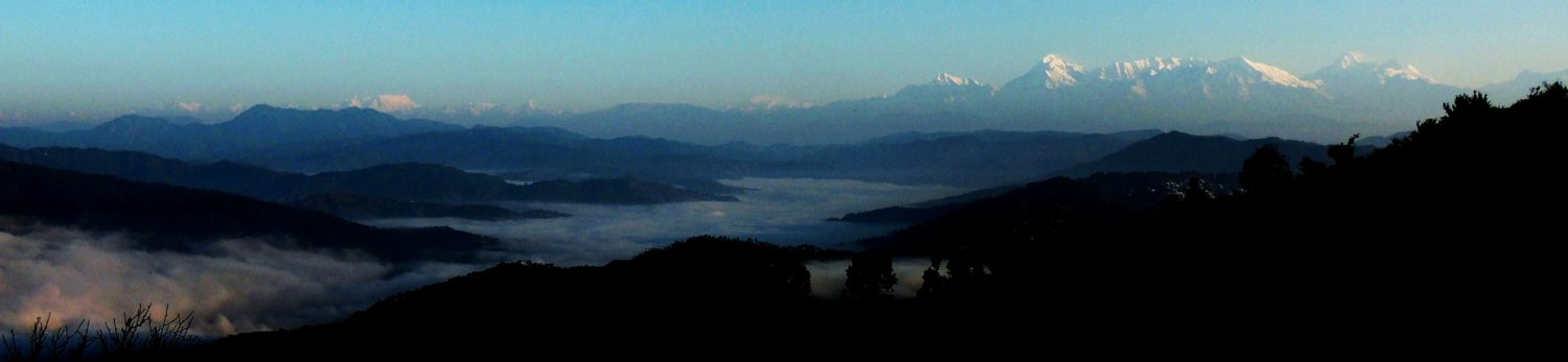

Chhattisgarh – an introduction
Chhattisgarh State is situated between Orissa and Jharkhand in the East and Madhya Pradesh and Maharashtra in the West. The state originally formed part of Madhya Pradesh. The capital is Raipur. The state is administratively divided into 16 districts. A third of the population is tribal. Major economic activities are agriculture, mining and forestry. The state has a mega steel plant at Bhilai and a few large cement factories due to its rich mineral resources.
In early times the area was known as South Kosala. Aryan migrants moving to the South of India passed through it. The spoken language is Hindi along with various tribal languages. . Various civilisations originated in Chhatisgarh of which Maurya, Saatvahan, Vakatak, Guptavansh, Nalvansh, Panduvansh, Somvanshi, Nagvanshi, Mandlik & Kalchuri (Haihayvanshi) Rajvansh are worthy of mention.
Five major rivers flow through Chhattisgarh, namely Mahanadi, Shivnath, Indravati, Hasdo and Kharun rivers. The State is thus a contrast of the modern as well as the tribal.
Raipur and Bilaspur are two major cities and convenient bases from where to visit the places of tourist interest. Bilaspur is a busy city and the Headquarters of the South Eastern Railway.
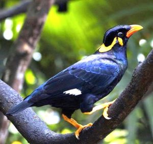
The main areas of interest to the tourist are Kawardha, Bastar, Jagdalpur, Amarkantak, Raipura and the wildlife sanctuaries. There are three national parks, namely the Sanjay Gandhi Udayan, Indrawati Tiger Project and Kanger Valley. There are sanctuaries at Badakhol, Barnawapara, Sitanade, Achanakmar, Semarsat, Tamar Pingla, Bhairamagarh, Pamed, Udanti and Gomarda.
 Other places of tourist interest in Chhattisgarh
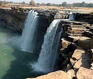
Some of the destinations of interest are Rajim, Champaranya, Sirpur, Ratanpur, Amarkantak, Dongargarh, Arang, Mainpat, Sheorianarayan, Malhar, Tala, Bhoramdeo, Bheemkhoj (Khallari), the water falls at Chotrakoot, Teerathgarh, Mandra, Chitradhara, Tamda, Dhoomar; caves at Kotamsar, Kailash, Aranyak, Sakal Narayan, Tular, Rani, Makar, Kanak & Dongare, Dantewada, Keshkal Valley and Charama Valley.
Tribal areas of Chhattisgarh
Scheduled Tribes are concentrated in the southern, the northern and the north-eastern districts. The highest concentration is in the erstwhile Bastar district. The new district of Dantewara has 79 percent tribals followed by Bastar (67 percent), Jashpur (65 percent), Surguja (57 percent) and Kanker (56 percent).
Economy
 The State plans to establish a “dry port” at Raipur and convert Jagdalpur into an ecology city. New Bilaspur and New Raipur are planned to be developed as modern, well planned cities and suburbs. The economic initiative includes encouraging foreign joint ventures for setting up new modern industrial parks.
Chhatisgarh was known as the “rice bowl” of Madhya Pradesh before it became an independent state and used to produce over seventy percent of the total paddy production in the state. It produces very little wheat. Apart from paddy, it grows cereals like maize, kodo-kutki and other small millets.
The region has abundant mineral resources; diamond, gold, iron-ore, coal, corundum, bauxite, dolomite, lime, tin and granite.
Slightly less than half of the geographical area of Chhatisgarh is covered by forest cover. Nearly one-third of the forests comprise Sal forests the produce from which provide livelihood to a large number of the population.
Irrigated area accounts for just about a fifth of the total cultivated area in Chhatisgarh. There are considerable variations between various districts. The net irrigated area to net sown area is 46 percent in Raipur but as low as seven percent in Raigarh, five percent in Surguja and three percent for the tribal area of Bastar.
Leave a Reply